Last updated on July 5th, 2026
Elevation’s Impact on Conditions
Temperature drops approximately 0.65 degrees Celsius for every 100 meters of elevation gain. This means a comfortable 20°C day in a valley at 800 meters translates to just 7°C at a mountain hut at 2,800 meters. The practical effect is significant—hikers often start in summer conditions and arrive at destinations requiring winter clothing layers.
Air pressure decreases with altitude, affecting both weather patterns and human physiology. Lower pressure at 3,000 meters means less oxygen per breath, requiring acclimatization for sustained exertion. The reduced pressure also affects cooking times and water boiling points, which mountain hut operators account for in their meal preparation.
Wind speeds increase substantially with elevation. Ridges and peaks experience wind velocities two to three times higher than nearby valleys. This wind chill effect makes temperature readings misleading—a 5°C day with 40 km/h winds feels considerably colder than the thermometer suggests. Exposed ridge walks require planning for wind exposure even during summer months.
Afternoon Thunderstorm Development
Summer weather in the Austrian Alps follows predictable daily patterns. Mornings typically offer clear conditions, with cumulus clouds beginning to form by mid-morning as solar heating warms the ground. These clouds develop through late morning and early afternoon, often building into cumulonimbus clouds capable of producing thunderstorms.
The storm development process accelerates in mountains compared to flat terrain. Peaks force air upward, triggering condensation and cloud formation. By early afternoon, particularly on hot days, towering thunderheads may cover the sky. Lightning poses serious danger on exposed ridges and summits, as hikers become the highest conductors in the landscape.
Experienced hikers in Austria plan routes to avoid exposed terrain during peak storm hours between 2 PM and 6 PM. Hiking tours in Austria typically structure itineraries with morning starts, reaching passes or summits by early afternoon, then descending before storms develop. This timing reduces lightning risk significantly.
Rain from these storms can be intense but usually passes within one to two hours. However, even brief heavy rain creates hazardous conditions—rock surfaces become slippery, small streams swell to dangerous levels, and visibility drops. Metal cables used for trail safety conduct electricity during storms, requiring hikers to avoid via ferrata routes once lightning begins.
Regional Weather Variations
Northern ranges in Austria receive more precipitation than southern areas. Weather systems moving from the Atlantic and North Sea deposit moisture when they encounter the northern Alpine barrier. Areas like the Karwendel and Kaiser mountains average higher annual rainfall than ranges farther south.
The southern Alps, particularly in East Tyrol and parts of Carinthia, experience more Mediterranean influence. These areas see more sunshine hours annually and less frequent precipitation. However, when storms do develop, they can be more intense, with heavier rainfall rates.
The Föhn wind creates distinctive weather patterns across the Austrian Alps. This warm, dry wind develops when air masses cross mountain ranges, warming as they descend the leeward side. Föhn conditions bring rapidly rising temperatures, extremely clear visibility, and gusty winds. While the clear skies appear inviting, the strong winds make hiking on ridges dangerous and can trigger rapid weather changes.
Seasonal Weather Characteristics
June marks the transition into hiking season, but conditions remain variable. Snowpack persists at high elevations, particularly on north-facing slopes. Late-season storms can deposit fresh snow above 2,500 meters even in mid-June. However, days are longest, providing maximum daylight for route completion.
July and August constitute the most stable weather period. Temperatures peak, snow retreats to permanent glaciers and shaded gullies, and precipitation patterns become more predictable. However, these months also see the most intense thunderstorm activity during afternoon hours. Heat can be a factor on exposed south-facing slopes, requiring adequate water and sun protection.
September brings autumn transitions. Temperatures moderate, providing comfortable hiking conditions. Storm frequency decreases compared to midsummer, though weather systems become less predictable. Snow can occur at any elevation by late September. Shorter days require earlier starts to complete routes in daylight.
Microclimate Effects
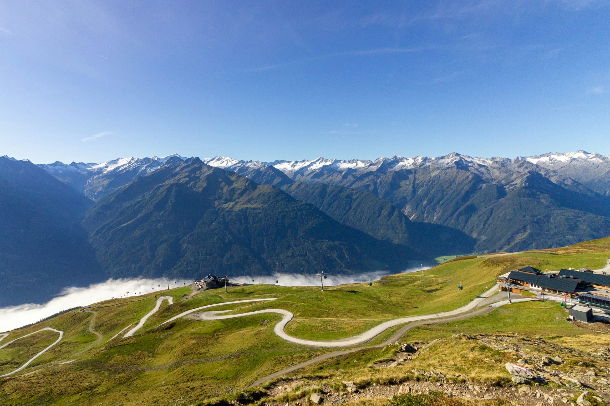
Valley systems create their own weather patterns. Cold air drainage means valley floors experience cooler nighttime temperatures than slopes several hundred meters higher. Morning fog often fills valleys while ridges remain clear. This inversion layer typically burns off by mid-morning but affects early route selection.
South-facing slopes receive significantly more solar radiation than north-facing aspects. This creates different vegetation zones, snow retention patterns, and hiking conditions. Trails on south slopes dry faster after rain, warm more quickly in morning, but can become uncomfortably hot during summer afternoons. North slopes retain snow longer, stay cooler, but may have muddier trail conditions.
Ridge positions between valleys experience wind funneling effects. Air flows through passes and gaps between peaks, accelerating as it compresses. Gaps that appear calm from below can have sustained winds making passage difficult or dangerous. Weather forecasts for general regions may not reflect these localized wind corridors.
Reading Weather Signs
Traditional weather prediction methods remain relevant in mountains where conditions change rapidly. Lenticular clouds—lens-shaped formations above peaks—indicate strong winds aloft and often precede weather deterioration. Rapidly building cumulus clouds signal potential storm development. A ring around the sun or moon suggests high ice crystals and possible precipitation within 24 hours.
Barometric pressure changes provide advance warning of weather shifts. Rapidly falling pressure indicates approaching low-pressure systems bringing precipitation and wind. Steady or rising pressure suggests stable conditions. Many hikers carry small altimeter watches that show pressure trends, useful for anticipating weather changes.
Animal behavior offers clues. Cattle moving from high pastures down to sheltered areas often precedes storms. Bird activity changes before weather deterioration—increased feeding activity as birds sense approaching poor conditions. While not scientifically reliable, these observations align with other weather indicators.
Technology and Forecasting
Modern weather forecasting has improved mountain weather prediction significantly. Models now resolve features at the valley and peak level rather than regional scales. Swiss and Austrian meteorological services provide specialized mountain forecasts including summit conditions, freezing levels, and thunderstorm probability.
Mobile phone coverage reaches most Austrian hiking areas, allowing hikers to check updated forecasts during trips. However, relying solely on technology creates vulnerability if devices fail or signals are unavailable. Understanding weather patterns and observational skills remain essential backup capabilities.
Weather apps designed for mountain use provide elevation-specific forecasts, radar images showing precipitation movement, and wind predictions for various altitudes. These tools help with hourly decision-making—whether to proceed over a pass, wait for conditions to improve, or select alternate routes.
Safety Protocols and Decision Making
Weather-related decisions involve assessing risk tolerance, group capabilities, and route options. Conservative approaches favor canceling or modifying plans when conditions deteriorate. Summit fever—the desire to complete a goal despite worsening weather—has led to numerous mountain accidents.
Establishing turnaround times independent of weather provides a safety margin. If a group hasn’t reached a specific point by a predetermined time, they return regardless of conditions. This prevents the common scenario where groups push forward into deteriorating afternoon weather.
Emergency shelter capabilities matter when weather traps hikers between destinations. Carrying basic bivouac equipment—emergency blanket, extra food, warm layers—allows waiting out storms safely rather than continuing through dangerous conditions. Most mountain accidents occur when groups push through bad weather rather than stopping to wait for improvement.